Thermal-Resilient Exploration Design – Planning City Movement Around Heat Index Mapping and Cooling Corridors

Urban travel is no longer just about routes, attractions, and convenience. Rising global temperatures, prolonged heatwaves, and expanding urban infrastructure have transformed cities into thermal landscapes that demand strategic planning. Traditional sightseeing itineraries often ignore microclimates, surface heat retention, and humidity levels, leaving travelers exposed to unnecessary heat stress. Thermal-Resilient Exploration Design redefines urban movement by integrating environmental intelligence into travel planning. Instead of simply navigating from point A to point B, explorers now consider heat index mapping, shaded corridors, cooling infrastructure, and time-sensitive mobility windows. In rapidly warming destinations such as Dubai and humid coastal environments like Karachi, this approach is not optional—it is essential for comfort, safety, and sustainable urban discovery.
Understanding Thermal-Resilient Exploration Design in Modern Cities

Urban Heat Islands and Their Impact on Exploration
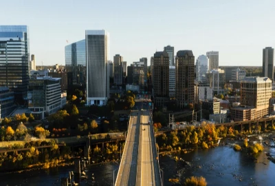
Urban heat islands occur when dense building materials such as asphalt, concrete, and glass absorb solar radiation and re-radiate it as heat. This phenomenon causes city centers to register significantly higher temperatures than surrounding rural areas. In cities like Phoenix and New Delhi, surface temperatures can climb dramatically during peak summer months, creating hazardous walking conditions. For travelers, this means that a seemingly short walking route can feel physically exhausting due to reflected and stored heat from pavement and high-rise structures.
Why Heat Index Matters More Than Temperature Alone
Air temperature does not fully capture how hot conditions feel. The heat index incorporates humidity, which affects the body’s ability to cool itself through sweat evaporation. In tropical cities such as Singapore, high humidity can elevate perceived temperature far beyond the thermometer reading. Travelers who rely solely on basic weather apps may underestimate their risk of dehydration and fatigue. Thermal-resilient planning emphasizes monitoring heat index forecasts and adjusting outdoor exposure accordingly.
Climate-Conscious Mobility as a New Travel Skill
Climate-aware mobility means designing routes that prioritize shade, airflow, and cooling access rather than simply distance. Travelers begin to assess tree canopy coverage, wind corridors between buildings, and shaded architectural pathways before stepping outside. This shift represents a fundamental change in urban exploration behavior—movement becomes guided by environmental intelligence instead of convenience alone.
Heat Index Mapping as the Foundation of Smart Urban Movement

Reading and Interpreting Urban Heat Maps
Heat index mapping provides granular insights into temperature distribution across city districts. In large metropolitan regions such as Los Angeles, certain neighborhoods can register significantly higher surface temperatures than nearby residential areas with more greenery. By studying these maps, travelers can identify high-risk zones and adjust routes to avoid prolonged exposure during peak hours.
Microclimate Variations Within the Same District
Even within a single neighborhood, microclimates vary based on building density, road material, and vegetation. A shaded residential street may feel dramatically cooler than an open commercial plaza. Understanding these subtle variations allows explorers to create thermally efficient pathways that reduce fatigue and overheating while maximizing sightseeing productivity.
Timing Routes Around Heat Accumulation Cycles
Heat mapping also reveals daily accumulation cycles. Early mornings typically offer lower pavement temperatures, while mid-afternoon reflects peak solar absorption. By scheduling outdoor-heavy activities during cooler windows and reserving indoor experiences for peak heat periods, travelers design itineraries aligned with environmental rhythms rather than fighting against them.
Cooling Corridors as Strategic Urban Lifelines

Green Infrastructure and Tree Canopy Networks
Cooling corridors often consist of interconnected parks, tree-lined boulevards, and landscaped pedestrian pathways. Large urban green spaces such as Central Park significantly reduce surrounding temperatures through evapotranspiration and shade coverage. Walking through these green networks can lower perceived temperatures by several degrees, offering both physiological relief and psychological comfort.
Waterfronts and Natural Ventilation Channels
Water bodies serve as passive cooling systems that moderate nearby temperatures. Coastal cities like Barcelona benefit from sea breezes that create natural airflow corridors. Planning movement along waterfront promenades during hotter hours can drastically improve comfort levels compared to inland concrete zones.
Architectural Design as Thermal Protection
Historic urban layouts often provide built-in shade through narrow alleys, arcades, and colonnades. In cities such as Rome, centuries-old architectural designs unintentionally function as climate-adaptive infrastructure. Travelers who prioritize shaded streets and covered walkways gain significant protection from direct solar radiation.
Designing Heat-Smart Daily Itineraries

Leveraging Cool Morning Windows for Outdoor Exploration
Morning hours present the safest opportunity for walking-intensive exploration. Lower humidity and reduced surface heat make outdoor landmarks more accessible and less physically taxing. Scheduling scenic viewpoints, markets, and open-air attractions early in the day preserves energy and minimizes exposure risk.
Using Midday Indoor Anchors to Avoid Peak Heat
Midday heat spikes demand strategic retreat into climate-controlled spaces. Cultural institutions such as the Louvre Museum provide immersive experiences while offering respite from extreme conditions. By aligning museum visits and indoor attractions with peak heat hours, travelers maintain productivity without compromising health.
Evening Mobility and Gradual Thermal Recovery
As temperatures decline after sunset, cities transform into safer walking environments. Evening exploration allows visitors to enjoy public squares, waterfront areas, and outdoor dining without the intensity of midday heat. This cyclical design creates a balanced rhythm of exposure and recovery throughout the day.
Technology and Wearables in Heat-Aware Exploration

Real-Time Environmental Monitoring Tools
Modern weather platforms now provide localized heat advisories and hourly forecasts. Integrating these alerts into travel planning enhances situational awareness and helps prevent unexpected heat exhaustion episodes.
Biometric Feedback and Hydration Tracking
Wearable fitness devices monitor heart rate variability and stress indicators, offering early warnings of heat strain. Tracking hydration levels ensures consistent fluid intake, which is critical in high heat index environments.
Smart Navigation with Shade and Comfort Metrics
Emerging navigation technologies incorporate shade density and pedestrian comfort data into route suggestions. These tools represent the future of climate-adaptive urban mobility, empowering travelers with data-driven decision-making.
The Future of Climate-Adaptive Urban Exploration

Urban Planning Trends Supporting Thermal Comfort
Cities worldwide are investing in reflective pavements, expanded tree canopies, and smart cooling systems. These infrastructure upgrades aim to reduce urban heat island intensity and improve pedestrian comfort long-term.
Tourism Season Shifts in a Warming Climate
As summer temperatures intensify, travelers are adjusting seasonal preferences and choosing shoulder-season visits. Climate resilience is becoming a deciding factor in destination selection.
A Behavioral Shift Toward Environmental Intelligence
Modern explorers are increasingly climate-aware. Understanding heat index patterns and cooling corridor networks is becoming as standard as checking transit schedules or booking accommodations.


Kate McCulley, the voice behind "Adventurous Kate," provides travel advice tailored for women. Her blog encourages safe and adventurous travel for female readers.
Kate McCulley
Prev Post
Next Post